


i-InfoTerre
Description of i-InfoTerre
i-InfoTerre is an Android application developed by BRGM, designed to provide users with access to geoscience data through an online cartographic interface. This app allows users to explore various thematic layers, including information on the basement, water boreholes, historical industrial sites, ground movements, underground cavities, and instances of shrinkage-swelling in the terrain. For anyone interested in geoscience, i-InfoTerre offers a valuable resource that can be easily downloaded and utilized on Android devices.
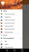
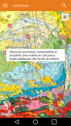
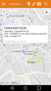
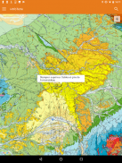
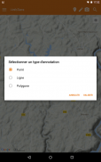
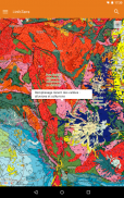
The application features a user-friendly interface that supports multiple base maps, such as orthophotos, plans, and geological maps. Users can navigate these maps using pan and zoom multitouch gestures, enabling them to explore specific areas of interest or view larger regions. Additionally, GPS functionality allows users to pinpoint their current location on the map, providing a personalized experience as they access relevant geoscience data in real time.
i-InfoTerre includes a comprehensive selection of thematic layers that cater to various interests and needs. Users can find information on water boreholes, which can be essential for understanding local water resources and their management. The app also provides data on old industrial sites, which may be significant for historical research or environmental assessments. Ground movement data is another critical aspect of the application, offering insights into potential geological hazards that may affect specific areas.
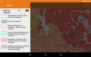
The app's emphasis on underground cavities and shrinkage-swelling phenomena is particularly beneficial for those studying geology and environmental science. By providing this information, i-InfoTerre aids users in understanding the geological characteristics of different regions and the potential implications for land use and safety. The quality of the data is regularly updated to reflect the latest scientific knowledge, ensuring that users have access to accurate and current information.
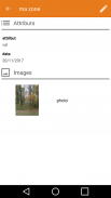
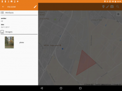
Users can access detailed metadata and notices regarding the quality characteristics of the data through specialized dissemination websites. This ensures that individuals seeking to rely on the information for professional, academic, or personal use can assess the reliability and precision of the data they are viewing. The application also respects legal constraints and individual freedoms, as certain sensitive data may not be accessible due to privacy or environmental protection concerns.
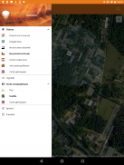
For those interested in municipal planning or local geology, i-InfoTerre includes a municipal directory feature that can help users find specific information related to their area. This can be particularly useful for local governments, environmental consultants, and researchers who require detailed geoscientific data for their projects or studies. The combination of thematic layers and location-based services creates a practical tool for a diverse range of users.
The app's multitouch functionality enhances the overall user experience, allowing for intuitive navigation. Users can easily zoom in and out to examine particular areas in detail or get a broader view of larger landscapes. This flexibility in map interaction is essential for users who may want to analyze specific geological features or assess environmental impacts across a wider region.
As i-InfoTerre continues to evolve, it may incorporate new features and data layers based on user feedback and advances in geoscience research. The application serves as an important platform for disseminating geoscientific information, making it accessible to a wider audience. Whether users are students, professionals, or simply curious about their environment, i-InfoTerre offers a valuable resource for engaging with geoscience data.
The app is designed to cater to a variety of user needs, from casual exploration to more rigorous academic research. Its accessibility on the Android platform ensures that a broad demographic can benefit from its features. By offering a range of thematic layers and user-friendly navigation, i-InfoTerre stands out as a significant tool for those interested in understanding the geological landscape. The ongoing updates and commitment to data quality further enhance its value, making it a relevant and reliable application for exploring geoscience.
i-InfoTerre is an essential resource for anyone looking to delve into geoscience data. Its combination of thematic layers, user-friendly design, and real-time location services make it a practical tool for exploration and research. Users can easily download i-InfoTerre and start navigating through the wealth of geoscientific information it provides, ultimately fostering a deeper understanding of the geological features that shape our world.
For additional information or to submit questions about the application, users can refer to the BRGM assistance site. This resource ensures that users can get the most out of their experience with i-InfoTerre, addressing any inquiries or issues they may encounter while using the app.
i-InfoTerre - Version 2.2.2
(27-04-2024)i-InfoTerre - APK Information
APK Version: 2.2.2Package: fr.brgm.iInfoTerreLatest Version of i-InfoTerre
Other versions


Apps in the same category

 4.044.383.783.65
You may also like...


